Search Results
Mappa dróg żelaznych: warszawsko-wiedeńskiej i krakowskiej z okolicami na szerokość 8 do 9 mil /
- Library catalog: Kartografia
- Data wydania: [1853]
- Sygnatura: A III 031
Atlas der R. K. missie in Nederlandsch Oost- en West-Indië /
- Library catalog: Kartografia
- Data wydania: 1928
- Sygnatura: A III 033
Verkehrs-Karte von Österreich-Ungarn :
- Library catalog: Kartografia
- Data wydania: 1910
- Sygnatura: A III 034
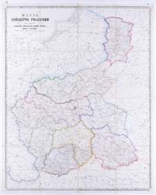
Mappa Królestwa Polskiego z nowym podziałem /
- Library catalog: Kartografia
- Data wydania: 1870
- Sygnatura: A III 043
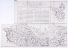
war they have undertaken in behalf of Turkey and the just right of nations, this map of the present seat of war, originally founded, and constructed, on the basis of remarkable Russian materials by the staff of the Austrian quartermaster-general at the command of field marshall prince Schwarzenberg, has been exactly reproduced (200 copies in ten days) /
- Library catalog: Kartografia
- Data wydania: 1854
- Sygnatura: A IV 044
Diercke Schulatlas für höhere Lehranstalten Grosse Ausgabe /
- Library catalog: Kartografia
- Data wydania: 1917.
- Sygnatura: A III 151
Atlas historyczny Polski /

- Library catalog: Kartografia
- Data wydania: 1928
- Sygnatura: A III 157
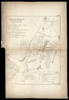
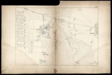
Schlacht von Wawre am 7/19 Febr. 1831.
- Library catalog: Kartografia
- Data wydania: 1832 ca]
- Sygnatura: A III 122
Schlacht bei Bialolenka am 12/24 Februar 1831.
- Library catalog: Kartografia
- Data wydania: 1832 ca]
- Sygnatura: A III 123
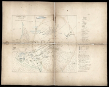
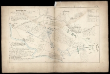
Schlacht von Grochow am 13/25 Februar 1831.
- Library catalog: Kartografia
- Data wydania: 1832 ca]
- Sygnatura: A III 124
Treffen bei Iganie am 29 März - 10 April 1831.
- Library catalog: Kartografia
- Data wydania: 1832 ca]
- Sygnatura: A III 125
Gefecht bei Nur [...] am 10\22 Mai 1831.
- Library catalog: Kartografia
- Data wydania: 1832 ca]
- Sygnatura: A III 126
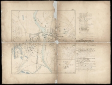
Schlacht von Ostrolenka am 14/26 May 1831.
- Library catalog: Kartografia
- Data wydania: 1832 ca]
- Sygnatura: A III 127
Kopia mapy katastralnej. Obręb Kromolice [...] /
- Library catalog: Kartografia
- Data wydania: 1935
- Sygnatura: A III 140
Knaurs Welt=Atlas:
- Library catalog: Kartografia
- Data wydania: 1939
- Sygnatura: A II 130
General-Karte von der Europaïschen Türkei :
- Library catalog: Kartografia
- Data wydania: 1853
- Sygnatura: A III 059
Geschäfts-Bericht der Direction der Königsberger Pferde-Eisenbahn-Gesellschaft für die General-Versammlung am 7. November 1881 /
- Library catalog: Kartografia
- Data wydania: 1881
- Sygnatura: A III 201
[Topograficzna Karta Królestwa Polskiego wyd. w r. 1843 z datą 1839 [...] /
- Library catalog: Kartografia
- Data wydania: 1863 ca]
- Sygnatura: A II 090
Deutscher Schulatlas /
- Library catalog: Kartografia
- Data wydania: 1943
- Sygnatura: A III 145
Historischer Schul-Atlas /
- Library catalog: Kartografia
- Autor: Putzger, Friedrich Wilhelm kartograf ; (1849-1913)
- Data wydania: 1931
- Sygnatura: A III 147

Viewed records 2181-2200 from 3236