Wyniki wyszukiwania
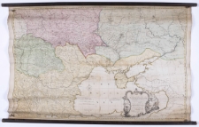
To His Excellency the Count of Czernihew Commander in Chief of Her Majesty the Empress of All the Russlas Fleet and Gallies Lieutenant General of her Armies, One of the Lords of Ber Admiralty, Ambasaddor Extraordinary and Plenipotentiary to this Majesty the King of Great Britain a Knight of the Order of the White Eagle, and St. Ann, [et]c. [et]c. [et]c. This map of the Present Seat of War between the Russians, Poles, and Turks is Most Humbly Inscribed by his Excellency's Most Humble and Most Obde-t Serv-t Andrew Dury /
- Katalog: Kartografia
- Data wydania: 1769
- Sygnatura: S 50
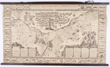
Nova illustrissimi principatus Pomeraniae descriptio :
- Katalog: Kartografia
- Autor: Lubin, Eilhard matematyk, kartograf ; (1565-1621)
- Data wydania: 1926
- Sygnatura: S 55
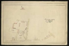
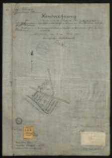
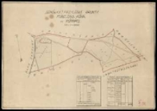
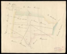
Plan sytuacyjny folw[arku] Kijewo.
- Katalog: Kartografia
- Data wydania: 1927 ca]
- Sygnatura: M I 105
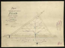
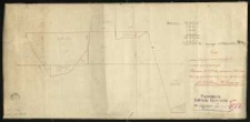
Projekt osączenia części majętności Kórnik powiat śremski /
- Katalog: Kartografia
- Data wydania: 1910
- Sygnatura: M I 106
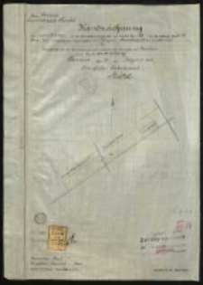
Kreis Schrimm, Gemeindebezirk Kurnik. Handzeichnung von den in der Grundsteuermutterrolle auf Artikel Nr 184 im Grundbuche Band - Blatt 383 eingetragenen Liegenschaften der verehelichten Marianna Handkiewicz und Geschwister Kubracki /
- Katalog: Kartografia
- Data wydania: 1906
- Sygnatura: M I 107
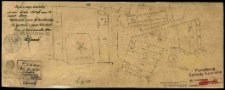
Projekt zalesienia dawniejszych nowin podgajskich na mapie czerwono oznaczonych.
- Katalog: Kartografia
- Data wydania: 1925 ca]
- Sygnatura: M I 112
Kreis Schrimm, Gemeindebezirk Kurnik. Handzeichnung von einem Teile des in der Grundsteuermutterrolle auf Artikel Nr 128, im Grundbuche Band 11 Blatt 453 eingetragenen Liegenschaften des Zamojski, Wladislaus Graf in Kurnik /
- Katalog: Kartografia
- Data wydania: 1906
- Sygnatura: M I 124
Kopja z mapy katastralnej od części obrębu Kórnik mapa 1 i 2 powiat Śrem. Mapa 2 /
- Katalog: Kartografia
- Data wydania: 1926
- Sygnatura: M I 126/2
Plan von dem Lust-Garten, Weinberg und Fasanorie zu Kornik :
- Katalog: Kartografia
- Data wydania: 1801.
- Sygnatura: M I 129
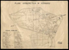
Plan arboretum w Kórniku.
- Katalog: Kartografia
- Data wydania: 1939 ante]
- Sygnatura: M I 142
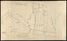
Plan sytuacyjny [budynków] folwarku Jarosławiec /
- Katalog: Kartografia
- Data wydania: 1927 ca]
- Sygnatura: M II 182
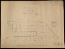
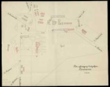
Gospodarstwo "po Serwatkiewiczu" w Konarskiem /
- Katalog: Kartografia
- Data wydania: 1881
- Sygnatura: M II 183
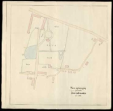
Szkółka i przyległe grunty. Fund[acja] "Zakł[ady] Kórn[ickie]" w Kórniku /
- Katalog: Kartografia
- Data wydania: 1927 ca]
- Sygnatura: M II 184
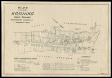
Plan miasta Kórnika powiat śremski, województwo poznańskie /
- Katalog: Kartografia
- Data wydania: 1939
- Sygnatura: M II 185
Kopia z mapy pod tyt[ułem]: Karte von dem Gute Konarskie Schrimmer Kreises /
- Katalog: Kartografia
- Data wydania: 1936
- Sygnatura: M II 186
Plan sytuacyjny budynków Konarzewa /
- Katalog: Kartografia
- Data wydania: 1937 ca]
- Sygnatura: M II 187
Plan sytuacyi gminy i Probostwa w Krerowie wykonany celem uzyskania pozwolenia odprowadzenia wody z drenów przez grunta Zimina i Bieganowa /
- Katalog: Kartografia
- Data wydania: [1930 ca]
- Sygnatura: M II 188
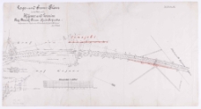
Lage- und Grenz-Plan in der Feldmark Kijewo und Zrenica Reg. Bezirk Posen Kreis Schroda /
- Katalog: Kartografia
- Data wydania: 1882
- Sygnatura: M II 195
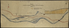
Projekt stawków do hodowli pstrągów w Dolinie Kościeliskiej.
- Katalog: Kartografia
- Data wydania: 1905 ca]
- Sygnatura: M II 219
Part of the South Pacific Showing the Track of H. M. S. "Pearl" During the Last Voyage of Commodore Goodenough /
- Katalog: Kartografia
- Data wydania: 1876
- Sygnatura: M III 007

Wyświetlono rekordy 1741-1760 z 3236